FAIR, through the National Flood Forum, has been engaging with residents in Brownhills to discuss their flood risks, particularly their on-going issues around surface water and sewerage flooding that have affected the community for 50 years. The National Flood Forum have been working closely with Risk Management Agencies to address flood issues in Brownhills, and are providing ongoing advice and support to residents affected by flooding. This community page displays monitoring from sensors installed by FAIR, as well as more information about how FAIR and the National Flood Forum are working to make the community more resilient to flood risks in Brownhills.
Community news
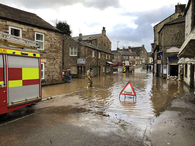
What is flooding?
Flooding is when land that is usually dry is covered in water. This can be for a short period of time, such as a few hours, or over longe...
Find out more
What is FAIR?
A FAIR (Flood: Aware, Informed, Resilient) Approach to Community Flood Risk is working innovatively and collaboratively to reduce fl...
Find out moreOther communities
Swipe across to see other communities