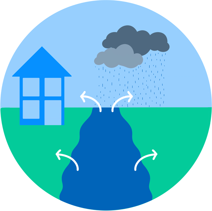
Also known as fluvial or riverine flooding, river flooding occurs in both main rivers and ordinary watercourses when the volume of water in the channel exceeds its capacity. This causes the water level in the river channel to overtop its riverbank. This most commonly occurs when there has been a prolonged or heavy period of rainfall, which increases river levels due to:
- Runoff from surface water and inflow from sewer infrastructure to the rivers.
- Permeable surfaces (which allow water to soak into the ground) becoming saturated (full of water), increasing the rate of surface water runoff, so water reaches the river faster.
- Impermeable surfaces (that do not allow water to soak into the ground) having a quick surface water runoff rate that reaches rivers faster.
- Drainage systems conveying water to the river quickly.
- High flows in the river becoming restricted by structures (for example, bridges and culverts) causing water levels upstream to rise.
- Sediment and debris building up in river channels and reducing the river's capacity.
The difference between ‘main rivers’ and ‘ordinary watercourses’:
There are two types of watercourses in flood risk management: ‘main rivers’ and ‘ordinary watercourses’. Designated main rivers are usually large rivers and streams and are the responsibility of the Environment Agency for construction, maintenance and/ or improvement, to manage flood risk. There is more information about designating watercourses as main rivers on the gov.uk website.
Other watercourses are classified as 'ordinary', and fall under the responsibility of the Lead Local Flood Authorities, Internal Drainage Boards, and District or Borough Councils for management of flood risks. Riparian landowners are also responsible for the maintenance of a watercourse, both for main rivers and ordinary watercourses. For more information on these responsibilities, please see the Flood risk roles and responsibilities information page.

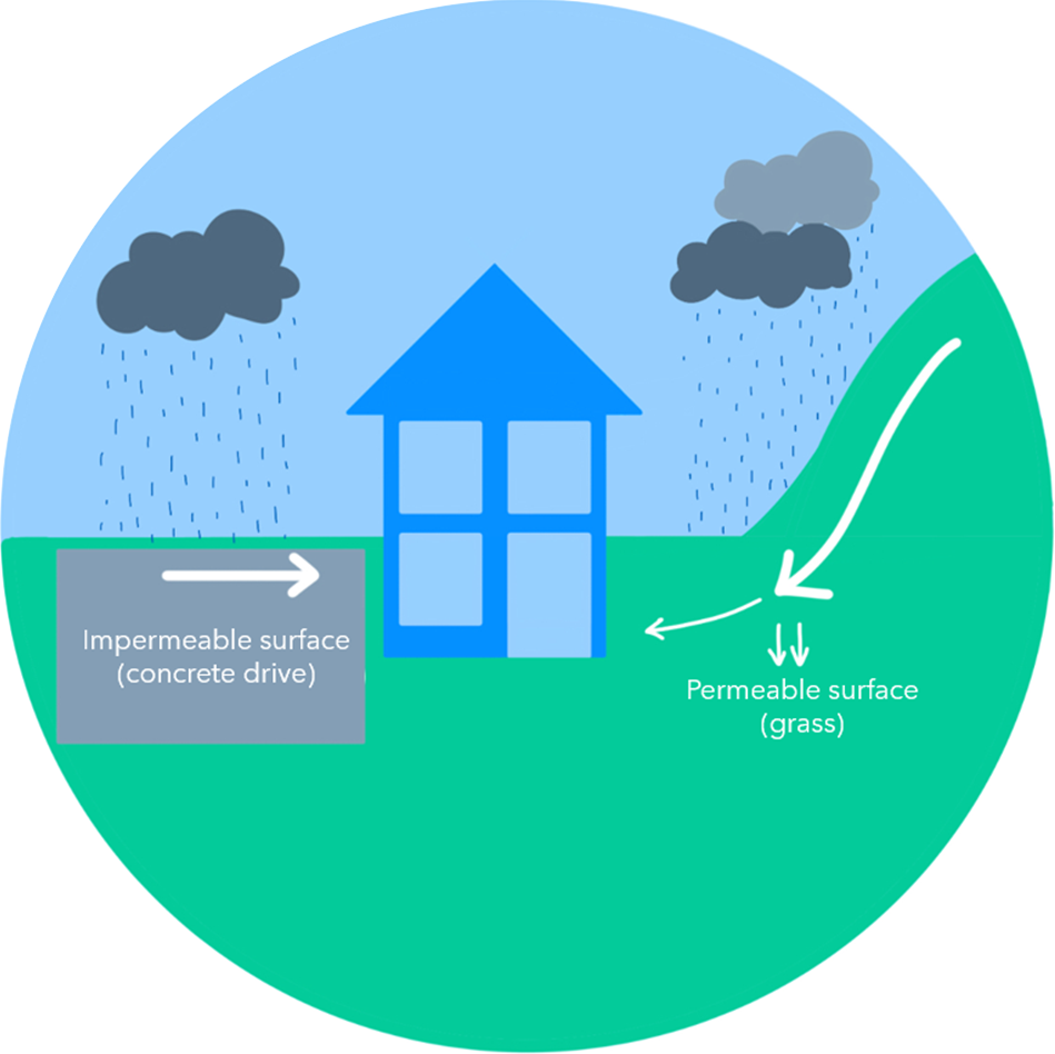
Surface water is rainwater which has not yet soaked into the ground or entered a watercourse, drainage system or sewer. Different ground characteristics influence how rainfall will behave.
Permeable surfaces, sometimes referred to as ‘soft surfaces’, allow water to soak (infiltrate) into the ground. Typical examples include gardens, parks, fields and green spaces.
Impermeable surfaces, sometimes referred to as ‘hard surfaces’, do not allow water to infiltrate into the ground, leading to surface water runoff. Examples of impermeable surfaces include highways and roads, roofs, car parks and public squares.
Also known as pluvial flooding, surface water flooding most commonly occurs when there has been a period of prolonged or heavy rainfall that:
- Falls onto permeable surfaces that have become saturated (full of water), so no more water can infiltrate into the ground.
- Is very intense, and the rain is falling onto the ground faster than it can infiltrate it.
- Is occurring after or during a prolonged warm and dry period, where permeable surfaces can become baked hard and be relatively impermeable.
- Falls onto impermeable surfaces, but the drainage system is already at capacity and so no more surface water can enter the system.
- Falls onto impermeable surfaces and there is no formal management of the rainfall.

When rain falls onto impermeable surfaces, it will typically enter a sewer. There are different types of sewers:
Surface Water Sewers drain rainfall and surface water away from properties to watercourses.
Foul Water Sewers drain wastewater away from properties to be treated.
Combined Sewers drain both wastewater from properties, along with runoff from highways, roofs, car parks and other sources.
Flooding from sewer infrastructure can occur under several circumstances, most commonly when:
- There is a period of heavy and/or prolonged rainfall that results in significant flows, exceeding the capacity of the sewer network. This prevents water from entering the sewer network and may result in surface water flooding.
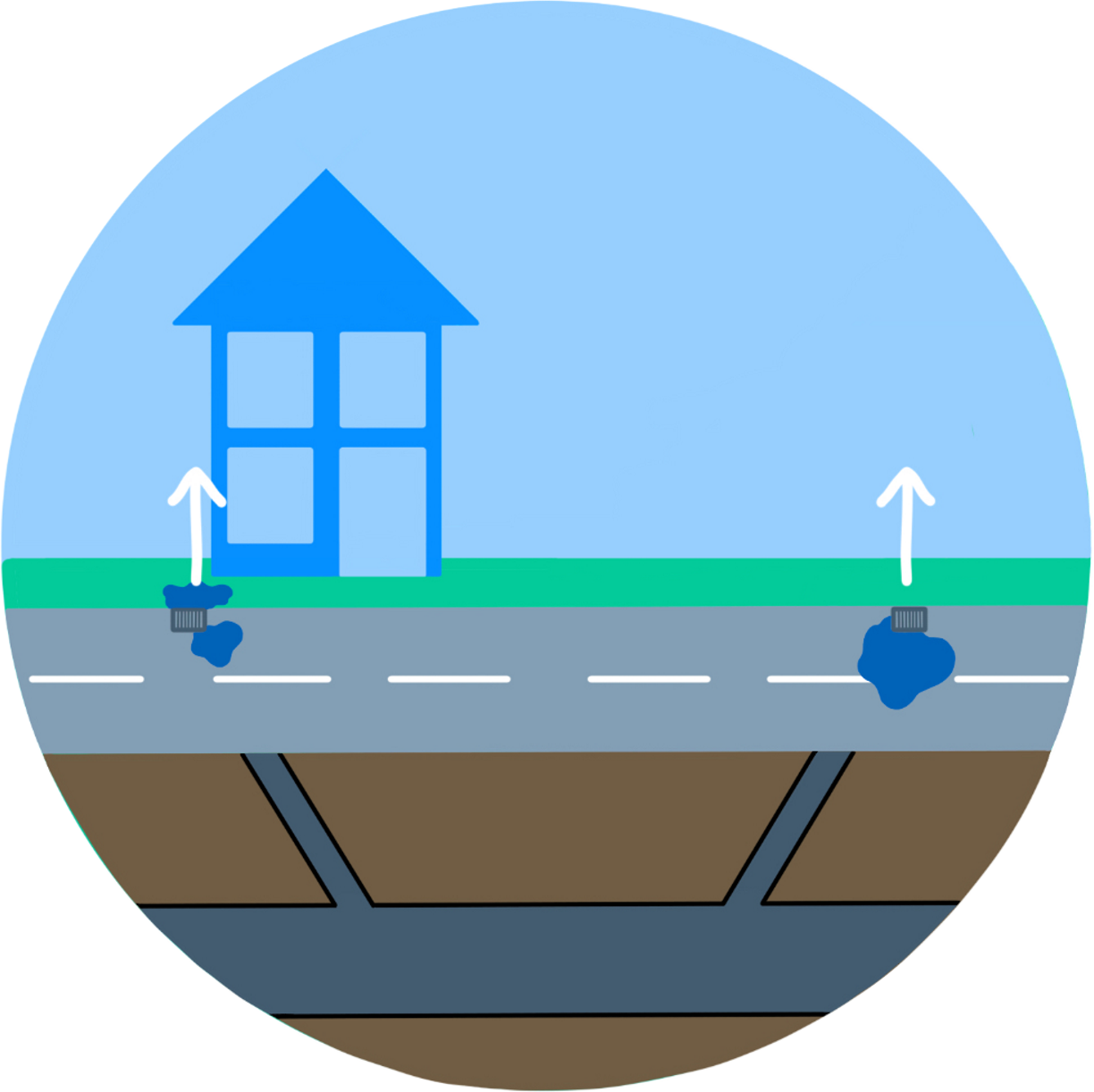
- There is a blockage, or the sewer itself collapses, which restricts or prevents flows within the sewer network. This causes water to back-up through the network and find its way to the surface, typically through a manhole or associated drainage structure.
- Water levels are high in watercourses, and surface water sewers are unable drain water away, which causes a back-up through the system.

Highway (road) drainage consists of gullies, drainage channels and other features that collect and drain rainfall away from highways. These features are typically located on either one or both sides of the highway. When rain falls onto the highway, it enters the drainage system, or it is carried within the highway channel until it enters a system or watercourse.
In new developments, it is common practice to use highways to transport surface water away from properties. However some properties are located at, or below, the level of the road. This means that if a carriage way is unable to contain the water flowing within it, these properties can be at risk of flooding.
Flooding from highway or road infrastructure can occur under several circumstances, most commonly when there is a period of prolonged or heavy rainfall that:
- Cannot enter the highway drainage due to a blockage or build-up of surface debris, typically rubbish, leaves or other road debris.
- Overwhelms the highway drainage features by falling faster than the drain is able to capture it.
- Cannot enter the highway drainage feature due to a sewer, culvert, or watercourse being at full capacity, meaning the highway runoff has nowhere to drain to.

Flash flooding is a term which is not specific to one type or source. Instead, it refers to flooding that occurs very suddenly, and usually during a period of heavy rainfall or storms.
Groundwater flooding describes water which is stored beneath the ground in cracks and gaps. The level at which this water sits is known as the water table. The water table can fluctuate with seasons and rainfall and can rise to the surface and result in groundwater flooding. This is more common in areas where the ground (bedrock) is chalk, but also in places with sand and gravel. Lead Local Flood Authorities oversee flooding from groundwater. However, groundwater flooding is not commonly a cause of flooding in Staffordshire and the Black Country.
Runoff is excess water that cannot soak into the ground and flows across the surface, or into rivers and watercourses. Runoff can occur on all surface types, including impermeable surfaces which water cannot infiltrate, such as roads. However, it can also include permeable surfaces, which may reduce in permeability if it is already saturated, or have been baked hard in hot weather.
Overland flow is a synonym of runoff, where water moves across the land surface. This term is often used in flood modelling.
Storm surges are changes in sea level, associated with high winds and low-pressure during storm events. This term is sometimes used as an alternative to coastal flooding. The Environment Agency oversee coastal flooding, which is not a cause of flooding in Staffordshire and the Black Country.